Showing posts with label Camping. Show all posts

MARYKNOLL ECOLOGICAL SANCTUARY

MARYKNOLL ECOLOGICAL SANCTUARY
Last updated:
03 August 2016


Location:
25 North Santo Tomas Road, Campo Sioco, Baguio City, Philippines.
Contact Details:
Email: mesbaguio@gmail.com;
Tel. No.: +63 74 424 5745;
CP No.: +63 915 655 5745
Registration Fee:
Php50.00.
Business Hours:
8:30AM to 4:30PM (Cosmic Journey closed on Mondays)
How to Get There:
·         Take a Campo Sioco jeep at the Igorot Park
·         Take a taxi.
·         For private car, drive to Marcos Highway, then take a right turn to North Santo Tomas Road

Description
Revisiting the Maryknoll Ecological Sanctuary had been a nostalgic moment to me as it had been a venue to several self-awareness activities with my students when I was working as a clinical nurse instructor. The stonehenge, the native huts, and concrete benches had been mute witnesses to some of my students’ priceless smiles as they recounted their best life experiences as well as tearful accounting of their struggles and how they coped with it. It is basically the perfect place when you want to unwind, find the inner peace in yourself, or  discover the balance in your stressful life.

The Maryknoll Ecological Sanctuary, a green museum, is located in the City of Pines just a few minute drive away from the hustle and bustle of the central business district. The green museum offers a two-hour Cosmic Journey among its several programs. The Cosmic Journey walks you to 14 stations depicting natural history along its easy trail.

Following the trail gives you a serene feeling that “challenges us to reassess our role and relationship with the Universe, and to refashion our way of life in conformity with nature” (Cosmic Journey, n.d.). This had been the biggest factor why this venue is good for self-awareness activities.

Reminders:

  • Follow the trail as indicated by the map given by the security guard.
  •  Do not pick flowers.
  • Do not vandalize any of the art forms along the trail.
  • Be guided by the Leave No Trace mantra.

Gallery

After securing a ticket, the security guard will direct you to the start of the journey.


Follow the stairs going up to the right, the left merges with the end of the journey.


You will not be lost as you will be guided by arrows, rails, and caricatures along the trail.
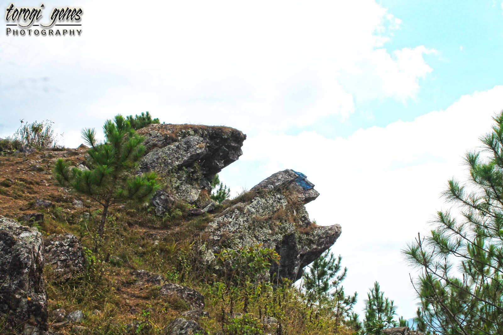

One of the ruins during the 1990s earthquake.


A good place to sit, relax, or even meditate. However, there are even better places along the trail.


Obviously, another building ruin.


The Hermitage near the ruins.


The first station.
“The universe came into being 13.7 billion years ago.”


Near the first station is a bell inscribed with “We are the Earth, the people, plants and animals, breath of the forest and flow of the sea.”


“I pledge allegiance to the Earth and to the flora, fauna and human life that it supports, one planet, indivisible, safe air, water and soil, economic justice equal rights and peace for all.”


Unfortunately, the concrete chairs arranged in a circular manner is located near a private building. I remember sitting and talking with my students before on those concrete chairs. I just cannot reconcile with my memory if the building was there before.


Another station.
“Planet Earth emerges 5 billion years ago.”


A depiction of the Stonehenge is the center of the second station.


One of the stonehenges. Don’t climb it just to have a selfie.


This is also located in the Stonehenge area serving as a gate or entry way.


Another place for chitchat though could only accommodate a few.


Another station.
“The oceans are the birthplace for life 3 ½ years ago. “


Adorned with shells, the min-pool at the center gives connection to the station. I remember burning papers inscribed with my students’ bitter memories here, a symbolic act of letting the bitterness of those memories go as we go on in our life.
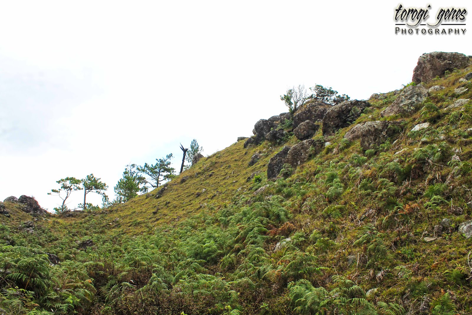

The sanctuary is a haven covered with pine trees and Chinese bamboo. During my revisit, the bamboos and grasses are abundant awaiting for pruning and mowing.


The side rails guides you to the next station. You might as well enjoy the plants along the way.


Another station.
“Dinosaurs on the scene 235 million years ago.”


Unfortunately, the art depiction on this station is on maintenance during my revisit. Anyway, it shows dinosaur eggs and a hatchling.


Another station.
“The mammals arrive 220 million years ago.”
Well, though we are mammals humans are not yet here, I think.


Another station.
“The birds take flight 150 years ago.”


A nest made out of pine needles.


Another station.
“Flowers spread on the earth 130 million years ago.”


A flower at the center of the circular stone bench depicting the station.


Another station.
Here we are!
“The primates come forth 65 million years ago.”


Charles Darwin versus the Bible, huh?


Another station.
“Early humans lives in caves 50,000 years ago.”


Depiction of the Tabon cave.


A note inside the “cave.”


Yeah, yeah, that is the exit from the cave. Don’t worry, you don’t need to crawl or slide like in real caves.


Lo, the bridge! I have seen a few of my extraordinarily brave students cower in this bridge.


From this vantage, you cannot see the full stretch of the bridge because of its upward curve.


Another station.
“The village period 10,000 years ago.”


A traditional Cordilleran village had been used to depict the flourishing of villages.


A closer look at one of the depiction of the native huts.


It’s not typical in a native hut but it’s an artwork I must say.


The campsite is near the traditional village.


The campsite as seen from a high vantage point.


A path leading to the next station. There is a comfort room to the left of the path (not shown in photo).


Another station.
“The earth gives sweet water.”


A well depicting the station’s theme.


Another station
“The emergence of the Earth’s religious traditions.”


A bulol depicting the station’s theme.


At this point, there are still few remaining station and artworks depicting each station’s theme. However, I was already engaged in a conversation with visitors like me in the sanctuary, thus I was not able to take images. This, I guess, is a cue that you need to visit the sanctuary to see the remaining artworks, the gallery [no images shown], take a coffee at Mollies Café, or you might try the other programs being offered.


REFERENCES:

Mt. Ulap Eco-Trail

MT. ULAP ECO-TRAIL


Updated article is migrated on this link:


Location: Ampucao, Itogon, Benguet, Philippines.
Trail: Tomtombek-Sta. Fe Ridge traverse (or backtrack).
Contact Number: 0928-483-1133; 0921-729-2726; 0946-340-4561.
Registration Area: Ampucao Barangay Hall
Registration Fee: Php100.00 per person.
Guide Fee: Php400.00  (max of 10 persons per guide). This will double to Php800.00 if you decide to camp for a night.
How to get there:
·         From Baguio City. Take a PUJ bound to Samuyao or Ampucao. The loading station is located behind Jollibee Magsaysay and beside Orion Drug. There's a couple of tarpaulins indicating “loading area for Mt. Ulap” posted near it. Fare as of April 2016 is Php31.00. Just inform the driver that you need to drop at the Ampucao Barangay Hall for the Mt. Ulap hike registration. PUJ fare from Sta. Fe to Baguio City is Php50.00.
·         From outside CAR. Take a bus bound to Baguio City. Follow above information.

Description
A newly formalized hiking destination, Mt. Ulap Eco-Trail, a less-than-an-hour drive from Baguio City, offers six stations which boast majestic views of Cordillera mountains, pine forests, grassland ranges, man-made stone stacks, picturesque boulders, and a faraway glimpse of the San Roque Dam and Philex mining area.

Mt. Ulap Eco-Trail is in close proximity to Baguio City unlike other popular hiking destinations in the region such as Mt. Ugo and Mt. Pulag. Travel time would be about 45 minutes depending on the traffic at the central business district. En route, you will pass by Camp John Hay, Philippine Military Academy, and Texas Instruments. Don’t get confused with the arch indicating Ampucao Elementary School at the drop-off area. Both the elementary school and barangay hall are located in the same compound. There is a table for registration with logbooks for Baguio City and NCR hikers attended by an officer. You will pay here the registration fee and guide fee. You will be assigned a guide according to the local queuing. An environmental orientation by your guide is a must before leaving the barangay hall. There are foods and bottled drinks peddled in the area, so don’t get nervous when you forgot to buy bottled water for the hike. There’s clean comfort rooms in case you need to attend to nature’s call or change clothes before the hike.

There are six stations along the trail. Tomtombek, the first station, is an easy walk from Ampucao Barangal Hall. A raised metal welcome board showing the stations marks the beginning of the upward assault. The next station, Ambanao Paoay, a 1,788 mASL peak, is adorned with man-made stone stacks. You may add your own design in here. Careful however not to erect it along a footpath. Camping is allowed at the lower portion of this station. Also, along this station, a portion of the San Roque Dam and Philex mining area can be seen. The third station, Gungal, at 1,814 mASL is characterized with rock boulders. Some tourists say that this part is the highlight of the trek. Taking a solo shot at the famous, pentacle-vandalized, Gungal rock seems to appeal to most hikers, thus making this the most populated station during the day. The fourth station and the 1,846 mASL summit, Mt. Ulap, is covered with grass. A concrete marker is seen in its highest point inscribed with the name of the Engineer who surveyed the area. Most of the campers favour this area than in Gungal. For campers, the magical sunset and sunrise is often sought here. There is a store and two open pit comfort room near the camping area. The fifth station, Pong-ol burial cave, is now closed to the public. Desecration of the sacred place as well as dangerous path are the reasons for its closure. Midway along the downhill path to the fifth station is a barricaded burial rock left. However, only a few bones were left by mummy thieves. Sta. Fe, the sixth station, marks the end of the trek.

Officially launched on 31 October 2015, hiking through Mt. Ulap Eco-Trail now means paying standard fees and adhering to its rules and regulations. According to a local guide, tour guide fees costs about Php500.00 before its official opening. Environmental prep talks is not done thus vandalism as well as desecration of the sacred burials areas is uncommon. As of April 2016, the Pong-ol Burial Caves is now closed to the public.

Reminders
·         Practice the Leave-No-Trace (LNT) principle when visiting and camping.
·         Do not vandalize the stone and tree trunks.
·         Closing of registration at Ampucao Barangay Hall is 2:00PM. If you are a slow hiker, register before lunch or earlier if you don’t intend to camp for the night.
·         The fees including the guide fee are standardized. There’s no bargaining for lower price. Take note that the fees are lower compared to other eco-trails.
·         During holidays and weekends, registration starts as early as 4AM. However, to make sure of the availability of an officer at the barangay hall, It doesn’t hurt to inform the Tourism Council through the numbers listed above.
·         To those who are not regular hikers, take time to prepare yourself physically and mentally.
·         The foot paths are slippery during rainy season. However, you still need to be vigilant during summer because the dried soil easily crumbles under when stepped on.

Gallery

The metal signage that marks the start of the six stations.


These are the sic stations of the Eco-Trail. However, to protect and preserve the sacred burial site, the Pong-ol Burial Cave is now out of the regular trail offering.


The trail is slippery during rainy season but the danger is as much present during summer. You need shoes that can conquer the dry, brittle and pebbled footpaths. Sprained ankle is one of the most common injuries to hikers during summer.


These are gates for cattle. Never open and pass through these gates; use the wooden makeshift stairs.


This is the first boulder along the trail where you can have a glimpse of the picturesque Itogon, Mt. Ugo, and even the mountains of Pangasinan.


A typical yet enthralling view of The Cordillera.


Pine trees and more pine trees but you’ll never get tired of it.


A corral for cattle branding.


Notice that most of the trunks are scorched. During summer, the dried pine needles are very combustible. Please be responsible not to cause fire during your visit [to any mountain].


A patch of pine tree saplings.


You will notice a lot of fallen trees. This was caused by previous tropical storms.


Cattle herd near the Ambanao Paoay peak.


Ambanao Paoay, the second station, is adorned with man-made stone stacks. This peak and its neighbour peak are cluttered with rocks, thus, often named as twin peaks.


The trail ahead as it snakes along the side and on top of the mountain as seen from Ambanao Paoay.


Pinit (Rubus niveus Thumb.), an indigenous wild berry in Cordillera, are commonly seen along the trail. This wild berry is edible.


Grassy sloped and sometimes dotted with pine trees is but one of many of what the Eco-Trail can offer.


Even the dead pines trees have their own charm.


Grass-covered mountain top.


Pine trees and grassland: a perfect duo for the eyes.


You’ll love this more with a clear blue sky background.


We’re not there yet.


You need to be sure-footed.


Survivor pine tree.


Of ferns and stones.


Those seconds when you just want to sit and marvel at the beauty of the mountains.


Another boulder for photo ops.


Another angle of the previous picture.


Let’s continue the trek.


Further along the trail.


Like walking at the top of the world.


Grace even during death.


And we are at Gungal station!


The famous pentacle-vandalized Gungal rock, where the heaviest hiker traffic happens. When taking a selfie, dangling your feet at the edge is now prohibited.


The trail out of Gungal station.


A closer look at the grass that covers the mountains.


Grassland ho!


More grassland.


The lines seen in the photo are actually cattle  paths made for years.


Never pull sapling when heaving your body upwards along difficult trails.


A downhill path before the upward assault to the summit.


These fences either denotes the boundary of land ownership or serves as safety barricade for cattle.


Another indigenous plant along the trail.


A mossy area near the summit.


The marker at the highest point at the summit. Engineer Lagman is the first surveyor of the then known as Pong-ol mountain. However, he forgot the name and just wrote what he saw, obviously, ulap (clouds).


The summit—Mt. Ulap.


Start of descend from the summit.


More cattle!


Cattle close up.


Another angle.


A glimpse of where we've walked.


The camping site.


A stall selling refreshments near the campsite.


The camp site has a nice flat surface.


Parts of the downhill trail were steps made with pine branches.


Shower areas, refreshments stalls and souvenir shops are available along Sta. Fe.


Concrete foot paths near the road.


You will pass through a number of hanging bridges.